When you buy through our links, we may earn a commission. See our Affiliate Policy.
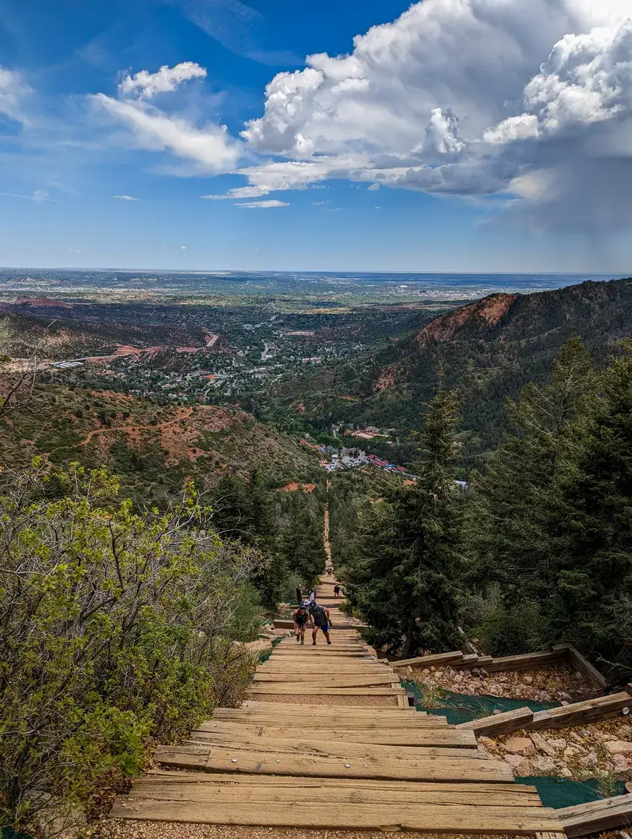
The Manitou Incline is one of the most challenging hikes we’ve done. In less than a mile, you’ll climb nearly 2,000 feet by hiking up an old railway that’s been turned into a staircase with 2,744 steps (though the top step is numbered 2,768).
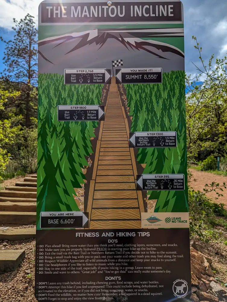
The trail climbs from about 6,600 feet all the way up to 8,550 feet above sea level with an average grade around 45% and some sections reaching nearly 68%. This really is a very different experience than your typical trail and is an intense workout that brings in around 700,000 visitors each year.
The Manitou Incline (nicknamed the ‘Stairway to Heaven’) is located on the eastern slope of the Rocky Mountains in Manitou Springs, just west of Colorado Springs. This is one of Colorado’s most iconic hikes.
If you’re planning your own hike, here’s everything we learned about the reservations, parking and climbing one of Colorado’s toughest trails.
What to Know Before Hiking the Manitou Incline
We had set aside just one day to hike the Manitou Incline before continuing our cross-country road trip, so we wanted to make sure we were prepared before making the drive to Manitou Springs. Here’s what we learned from our experience.
When is a Good Time to Hike the Manitou Incline?
The best time to climb the Manitou Incline is when it’s cooler out like early in the mornings or later in the afternoon. Midday sun and heat, especially at higher elevations and during summer months can make an already difficult hike even more of a challenge.
We climbed in late May during the early afternoon and were fortunate that temperatures were still comfortable.
Manitou Springs WeatherReservations and Packing
Although the Incline is free to hike, you do need a reservation before climbing. Reservations are available through the Colorado Springs website.
We reserved our spot a few days before our hike and had hoped we’d be able to climb early in the morning, but the only available times were in the early afternoon. We reserved ours for 1pm. We took the morning to prepare by hydrating, packing our backpacks and making sure we had everything we needed for the climb.
We carried about 4 liters of water, salty snacks, energy gels, a small first aid kit, sunscreen (sunburns happen faster at higher elevation), hats, sunglasses and our hiking poles. Our poles gave us some added stability since the railroad ties start to become taller the higher you climb.
Parking
We found parking to be one of the more confusing parts of hiking the Incline. There are a couple of parking options near the trailhead, like the Hiawatha Gardens Parking Lot and Iron Springs Chateau. You’ll need to walk about 1.3 miles to the Incline if you park at Hiawatha Gardens, but they also run the free year-round Shuttle #33 from 6am to 8pm. You can reserve a parking spot online, too.
We made the mistake of assuming parking would be easier than it was. After reading that hiking the Incline was free, we thought there would be plenty of parking nearby. That was not the case, but we were lucky enough to find a spot outside Iron Springs Chateau which cost us $15 for four hours of parking.
Altitude
The elevation is something that makes the already challenging climb even more difficult. The trail starts around 6,600 feet above sea level, which is already higher than a lot of people are used to. The thinner air up there can make the climb feel harder, even if you’re already in good physical condition.
If you have time, spending a day or two getting used to the elevation before the climb can make a difference. And, during the hike, make sure to take breaks whenever you’re feeling winded, drink plenty of water and listen to your body.
Headaches, dizziness, nausea or difficulty breathing are signs that you need to slow down or move to lower elevation.
Can You Turn Around?
If you start the climb and realize you’re not going to make it to the top, you have options. However, you should not turn around and descend the stairs. Going back down the Incline is dangerous and strongly discouraged. Instead, the Incline has a couple bailout points that you can take to safely exit before reaching the top.
You can take the Northern Incline Return Trail at stair 395 (with a 0.35 mile walk to base) or stair 1,300 (with a 1.5 mile walk to the base). Barr Trail also intersects the Incline at stair 1,800 and again at the summit (step 2,744).
If you make it to the summit, Barr Trail takes you back down to the base along a 4-mile route with switchbacks.
Is the Manitou Incline Dangerous?
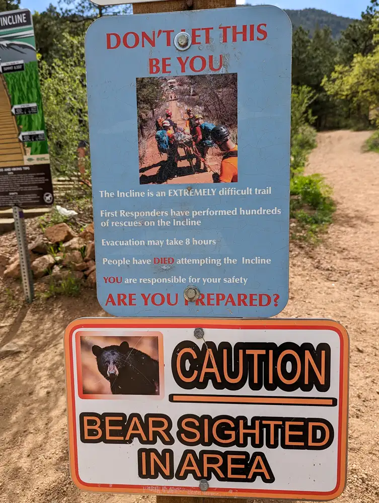
The Manitou Incline is a difficult hike and one of the biggest mistakes can be treating this like a normal staircase. The 2,700+ stairs, steep grades and high elevation do catch people off guard.
While thousands of people climb it each year, rescues are not uncommon. With the steep terrain, this makes emergency evacuations difficult and lengthy. Sometimes it can take several hours for first responders to reach hikers.
The best thing you can do is listen to your body, take breaks when you need them, bring and drink plenty of water and don’t feel like you need to summit.
Also keep in mind that wildlife, such as bears, have been seen on these trails. Always stay aware of your surroundings and respect the trail.
Our Experience Hiking the Manitou Incline
Arriving in Colorado Springs
We arrived in Colorado Springs on May 28, 2023, and stayed in a small Airbnb just south of Briargate. Stopping in Colorado Springs was a part of a larger cross-country road trip we were taking to Mount Rainier National Park in Washington state, and we had set aside just two days to explore this part of Colorado.
We spent our first day exploring Great Sand Dunes National Park and left the second for us to climb the Incline.
Arriving at the Trailhead
We reserved our spot on the Manitou Incline a few days before our hike. We were hoping for a morning climb, but the only available reservations were around 1pm.
Before we drove to the trailhead, we spent the morning hydrating and making sure we had everything packed for our climb.
Parking ended up being more of a challenge than we expected. After reading that the Incline itself was free to hike, we thought we’d be able to find parking fairly easily. That was definitely not the case.
Luckily, we found a spot outside Iron Springs Chateau which cost us $15 for four hours of parking.
We grabbed our backpacks, hiking poles and water from the back of the car and made our way towards the base of the Incline.
Seeing the Incline for the First Time
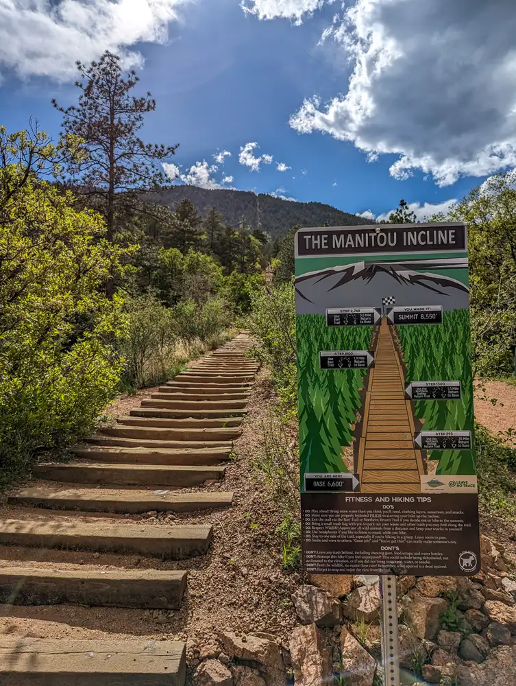
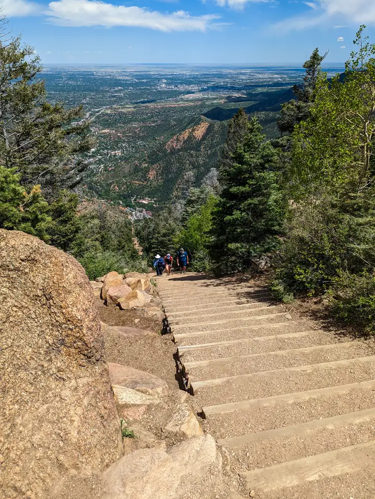
Seeing photos of the Incline didn’t really prepare us for seeing it in person. Looking directly up at 2,744 stairs made us wonder what we had signed up for.
During my time at UW-Eau Claire, I became pretty used to taking their infamous 95 stairs which connected upper and lower campus. Or possibly like using a StairMaster at the gym. So I thought I knew what kind of challenge this would feel like. But the Incline quickly showed me that this was going to be completely different.
Climbing the Incline
We started our climb one step at a time. Even though we started in the afternoon, hiking in late May had us avoiding the worst summer heat. The average high was around 70°F which was a very welcome change from the warmer temperatures we are used to in Alabama.
The first part of the trail was pretty easy. The railroad ties were low like regular stairs and spaced farther apart. But the higher we climbed, the taller and more challenging the steps became.
We used our hiking poles for both balance and support. They really came in handy when the railroad ties became taller and we had to lift our legs higher with each step.
The False Summit
One thing we noticed while climbing was just how many people were climbing it together. We still saw plenty of solo hikers, we saw a lot of couples, families and groups encouraging each other on the way up.
We both encouraged each other on the way up, but also encouraged each other to take breaks. Our mantra for the climb became “one step at a time.”
Our mantra really helped us push past the false summit. Also known as “The Bailout”, this section is where the Barr Trail intersects with the Incline around step 2,200 of the 2,744 stairs. After climbing for so long, reaching this point can feel like the perfect place to stop and head back down.
But looking back at how far we had already climbed gave us the motivation we needed to keep going.
Reaching the Summit
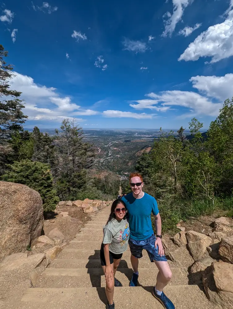
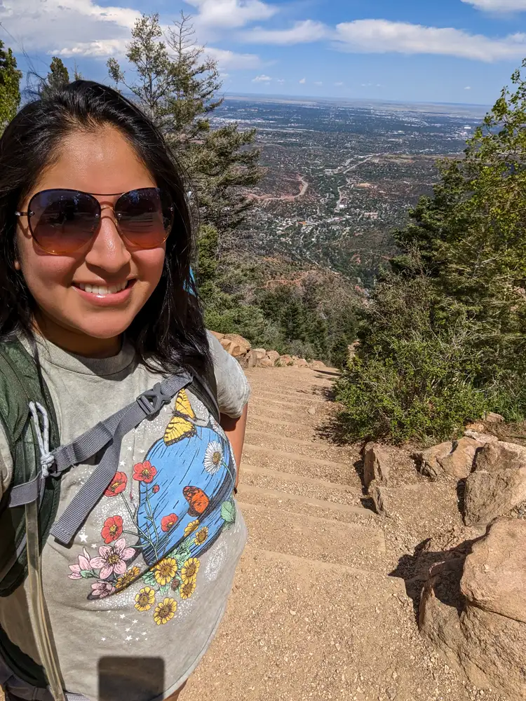
We reached the summit around 2:30pm, a little over an hour into the climb. It felt like such an accomplishment after climbing our way up thousands of steps.
The summit was filled with hikers celebrating their accomplishment. Even those who had summitted before us were cheering on those who were still making their way up.
We joined in and cheered on others still making their way up. The encouragement went both ways, and it was one of the things that stood out most about the experience.
Hiking Back Down Barr Trail
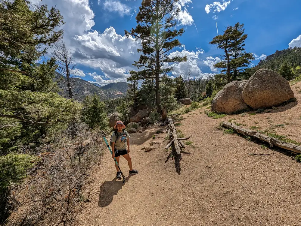
After spending some time at the summit and catching our breath, we began our descent down Barr Trail which is a 3.5-mile switchback hike that brings you back to the base.
We enjoyed the descent after the intense climb. One thing that caught us off guard was that we realized we had finished all 4 liters of our water but had barely broken a sweat all day. We even finished the Barr Trail without needing to use the restroom after, which was a good reminder of just how much water our bodies needed during the climb.
History of the Manitou Incline
While today the Manitou Incline is known as one of Colorado’s toughest hikes, it wasn’t originally built as a hiking trail. The Incline dates back to 1907, when it was constructed as a funicular railway to help build a hydroelectric plant and waterline on the mountain.
The railway used a cable system to move supplies up and down the steep mountainside in wooden boxcars. After the construction was complete, Dr. Newton M. Brumback purchased the railway and transformed it into a tourist attraction, allowing visitors to ride up to Mount Manitou Park and enjoy views of the surrounding area.
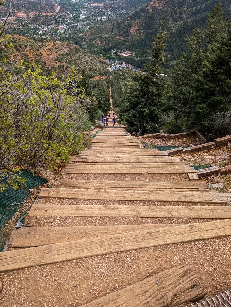
The railway eventually closed in 1990 after rising operating costs and damage from a rock slide made it too difficult to maintain. While the carts and rails were removed, the original railroad ties remained.
Those same railroad ties now form the staircase that thousands of hikers climb every year.
Things to do in Colorado Springs
One of the reasons that the Manitou Incline is so popular is because there is so many things to do in the Colorado Springs area. You really can spend the rest of your trip exploring some of the area’s other outdoor adventures.
You’ll find awesome places like Garden of the Gods, Pikes Peak and the Cheyenne Mountain Zoo. The area is also great for hiking, climbing, biking and exploring the Rocky Mountains.
If you are looking for another stair challenge, check out Seven Falls in South Cheyenne Canyon. It features 224 steep steps running directly alongside seven cascading waterfalls. It’s shorter and less intense than the Incline. Plus, it’s dog-friendly!
If you’re planning a trip to Colorado, don’t miss the Manitou Springs Incline. It’s a challenge you’ll never forget and the views are incredible.
Want more hiking tips and travel guides? Subscribe to our newsletter and join us on more epic adventures!
Leave a Reply